
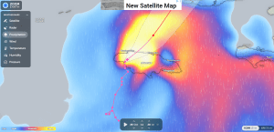
Hurricane Melissa precipitation and radar overlay showing its track over Jamaica, captured via Zoom Earth on October 28, 2025. Used under fair use for editorial reporting; Zoom Earth lists no usage restrictions for public radar and satellite imagery.
By SHR Media Staff
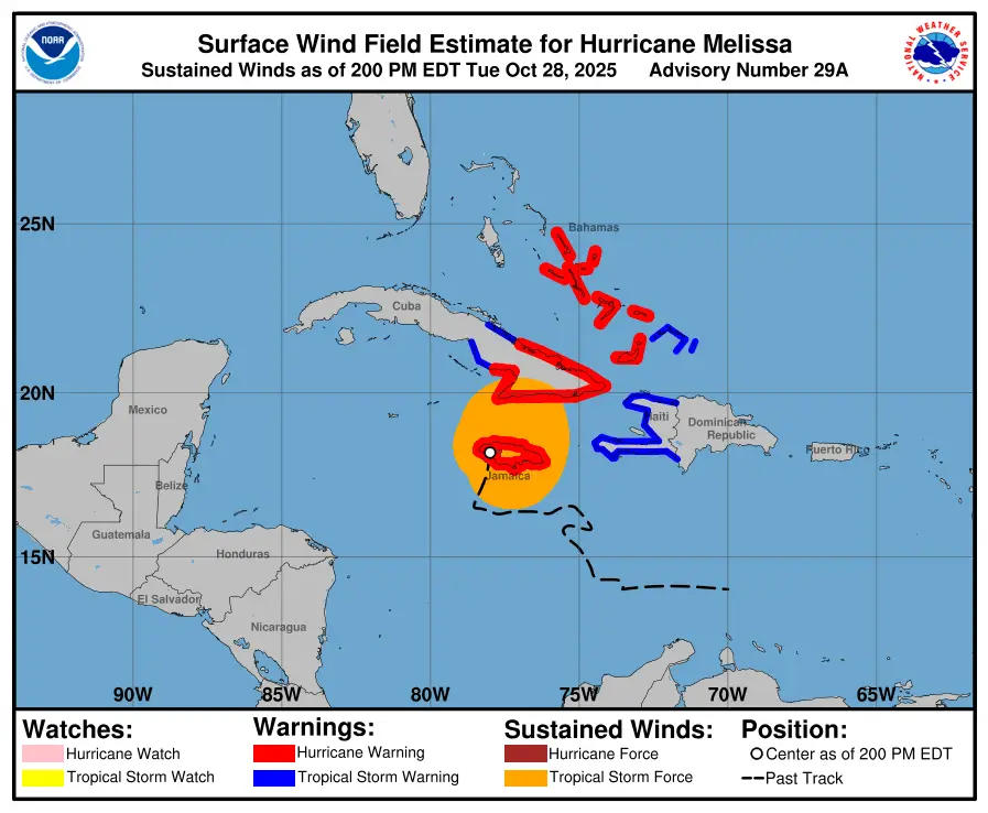
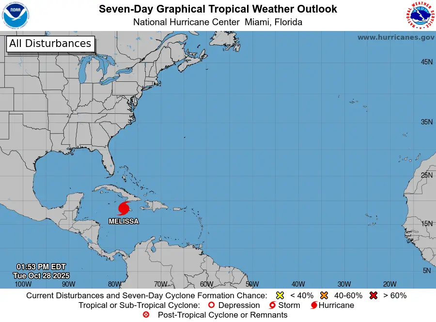
Hurricane Melissa has rapidly intensified into one of the strongest Atlantic storms ever recorded, reaching sustained winds of 185 miles per hour and a central pressure of 892 millibars as it moved toward Jamaica on October 28.
According to the National Hurricane Center, Melissa’s compact eye has remained stable for more than 12 hours, signaling a powerful and organized system. The storm’s forward speed slowed to about 8 miles per hour, increasing the risk of prolonged wind damage, flash flooding, and storm surge for Jamaica and nearby islands.
Impact on Jamaica
Authorities in Jamaica have issued hurricane warnings for the entire island. Coastal and low-lying areas have been ordered evacuated, with emergency shelters opened across Kingston, St. Elizabeth, and Portland parishes. The Meteorological Service of Jamaica reported expected rainfall totals between 10 and 20 inches, with isolated amounts above 25 inches possible.
The Jamaica Public Service Company began pre-emptive power shutdowns in several parishes to reduce infrastructure damage. Airports in Kingston and Montego Bay suspended all operations.
Hurricane Hunter Missions
Aircrews from the United States Air Force Reserve’s 53rd Weather Reconnaissance Squadron and the National Oceanic and Atmospheric Administration’s “Hurricane Hunters” conducted multiple penetrations of Melissa’s eyewall to collect real-time data.
During one mission, crews encountered extreme turbulence and were forced to terminate the flight early for safety inspection. The reconnaissance data confirmed Melissa’s rapid intensification and recorded wind speeds exceeding 185 miles per hour at flight level.
The flights also documented a sharply defined ten-mile-wide eye and storm-top cloud heights surpassing 50,000 feet, consistent with a Category 5 hurricane.
A 53rd Weather Reconnaissance Squadron crew, known as the Air Force Reserve “Hurricane Hunters,” encountered extreme turbulence while flying into the eye of Hurricane Melissa on October 28. The aircraft, operating under call sign TEAL 75, briefly experienced forces stronger than normal before the mission was aborted. The crew returned safely to their forward operating base in Curaçao, where the aircraft is undergoing inspection for potential structural damage as part of standard safety protocol. The 53rd WRS is an Air Force Reserve unit assigned to the 403rd Wing at Keesler Air Force Base, Mississippi.

Forecast and Warnings
The National Hurricane Center projects Melissa to cross central Jamaica late Tuesday night before moving northwest toward the Cayman Islands. Life-threatening storm surge is expected along Jamaica’s southern coast, where water levels may rise 10 to 15 feet above normal tide levels.
Heavy rainfall is likely to cause flash flooding and landslides in mountainous terrain. Officials in the Cayman Islands and parts of eastern Cuba have begun storm preparations and issued watches in advance of Melissa’s projected path.
Maritime authorities have suspended shipping and port operations throughout the central Caribbean. Airlines have canceled regional flights, and cruise lines have diverted scheduled routes.
Regional and International Response
The Caribbean Disaster Emergency Management Agency activated its regional coordination plan. The United States Agency for International Development pre-positioned response teams and relief supplies in Puerto Rico and Miami for rapid deployment once conditions allow.
International aid organizations are standing by to assist Jamaica after the storm’s passage.
Editorial Closure
Hurricane Melissa stands as one of the most powerful storms ever to strike the Caribbean. SHR Media will continue to monitor updates from the National Hurricane Center, Jamaica’s Meteorological Service, and official emergency agencies as verified information becomes available.
Reference Links (For Verification and Attribution Only)
- National Hurricane Center – Public Advisories and Reconnaissance Data
- NOAA Hurricane Hunters – 53rd Weather Reconnaissance Squadron Updates
- Meteorological Service of Jamaica – Official Bulletins
- Caribbean Disaster Emergency Management Agency – Situation Reports
About the Author
Discover more from SHR Media
Subscribe to get the latest posts sent to your email.